| Basic Information about the Iron Mountains |
|
- Location, Relief, Climate
- Geological Composition
- Waters
- - People, Architecture, History - Nature - Recreation and Tourism - Getting There - |
|
|
|
 |
|
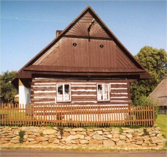
People, Architecture, History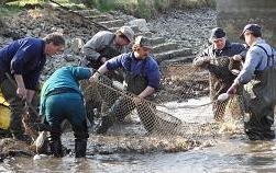 The castle ruins, small villages with folk architecture, small timbered houses, small chapels and churches, folk customs and crafts...
all of these you can see in the Iron Mountains as a reminder of those, who lived there dozens and hundreds of years ago.
There are also celtic remains near Nasavrky dated 2 centuries B.C.
The castle ruins, small villages with folk architecture, small timbered houses, small chapels and churches, folk customs and crafts...
all of these you can see in the Iron Mountains as a reminder of those, who lived there dozens and hundreds of years ago.
There are also celtic remains near Nasavrky dated 2 centuries B.C.But you can see also dams, steel towers, quarries and new houses as a reminder of people still living there. 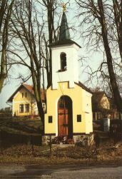
Current population density in the Iron Mountains is about 64 inhibatants per square km with the only one town reaching over 10.000 inhabitants. If you would like to see what was the ordinary life of local people some centuries ago you can visit The Highlands Folk Architecture Skansen near Hlinsko. 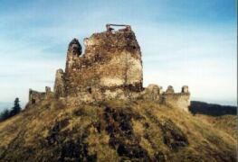 You can feel the past all around also thanks to many ruins of old castles here (Lichnice, Oheb, Vildstejn, Rabstejnek, Zumberk, Stradov, Rozpakov) and
many old memorable trees. The oldest oak in Podhradi is over 700 years old with 13 m in circumference.
Another outstanding tree you can find in Klokočov. It is almost 1,000 years old linden.
You can feel the past all around also thanks to many ruins of old castles here (Lichnice, Oheb, Vildstejn, Rabstejnek, Zumberk, Stradov, Rozpakov) and
many old memorable trees. The oldest oak in Podhradi is over 700 years old with 13 m in circumference.
Another outstanding tree you can find in Klokočov. It is almost 1,000 years old linden.From the modern sights you can find 613 feet (187 m) tall TV transmitter near Krasne from 1960, former lime plant near Tremosnice, many dams, great limestone quarry near Prachovice. |
|
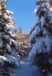
Recreation and Tourism The Iron Mountains today are a hiker's and biker'r paradise with many kilometres of well marked trails. 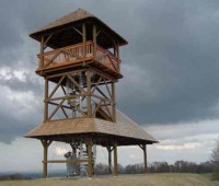 In winter you can do also cross-country skiing and limited downhill skiing especially in the estern (higher and colder) part.
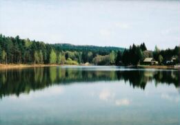
In summer you can enjoy swimming in a lot of ponds and beautiful small inundated quarries.
 Acomodation capacity is quite good including small lodging houses, private hotels, big hotels and camping site.
You can find some of hotel facilities in the pages main menu: accomodation.
If the visibility is good you can see also the Czech Republic's highest mountains - the Giant Mountains - with the main croak rising over5,250 feet (1600 m).
There are also some traditional sport events like over 60 miles (100 km) long biker's race "Bikemarathon Manitou Zelezné hory" in the Iron Mountains. Motosport is represented by several motocross races including the Europian Championships near Tremosnice. |
|
Getting There Plane The nearest major airport in Pardubice is about 12 miles (20 km) north of the Iron Mountains, Prague airport is about 60 miles (100 km) eastward. Car There is very dense road network here, so you can get almost anywhere by car. From Prague: D11 highway to E 39 - Podebrady, then direction Kolin, Caslav, Sec, Hlinsko. From Brno: D1 highway to E 162 - Velka Bites, then by route 37 via Zdar nad Sazavou to Zdirec nad Doubravou, then by route 34 to Hlinsko. Public Transportation You can get almost anywhere by bus, train stations in the Iron Mountains are as follows: Prachovice and Tremosnice in the central part, Hlinsko and Skutec in the eastern part, Zabori nad Labem and Tynec nad Labem in the western part. |

|
|
|
